Nowadays, it’s almost impossible to navigate a city without using a GPS navigation app. Either because you don’t know the streets or because you want to avoid traffic as much as possible. Google Maps, Waze, and Apple Maps are the main tools used by users, although in the United States, they clearly have a clear preference for their favorite. Although Waze has gained significant popularity and Apple Maps is the one most frequently used on their phones, Google Maps is the most popular choice among users.
Google Maps stands out for offering real-time traffic updates, alternative routes, multiple stops…
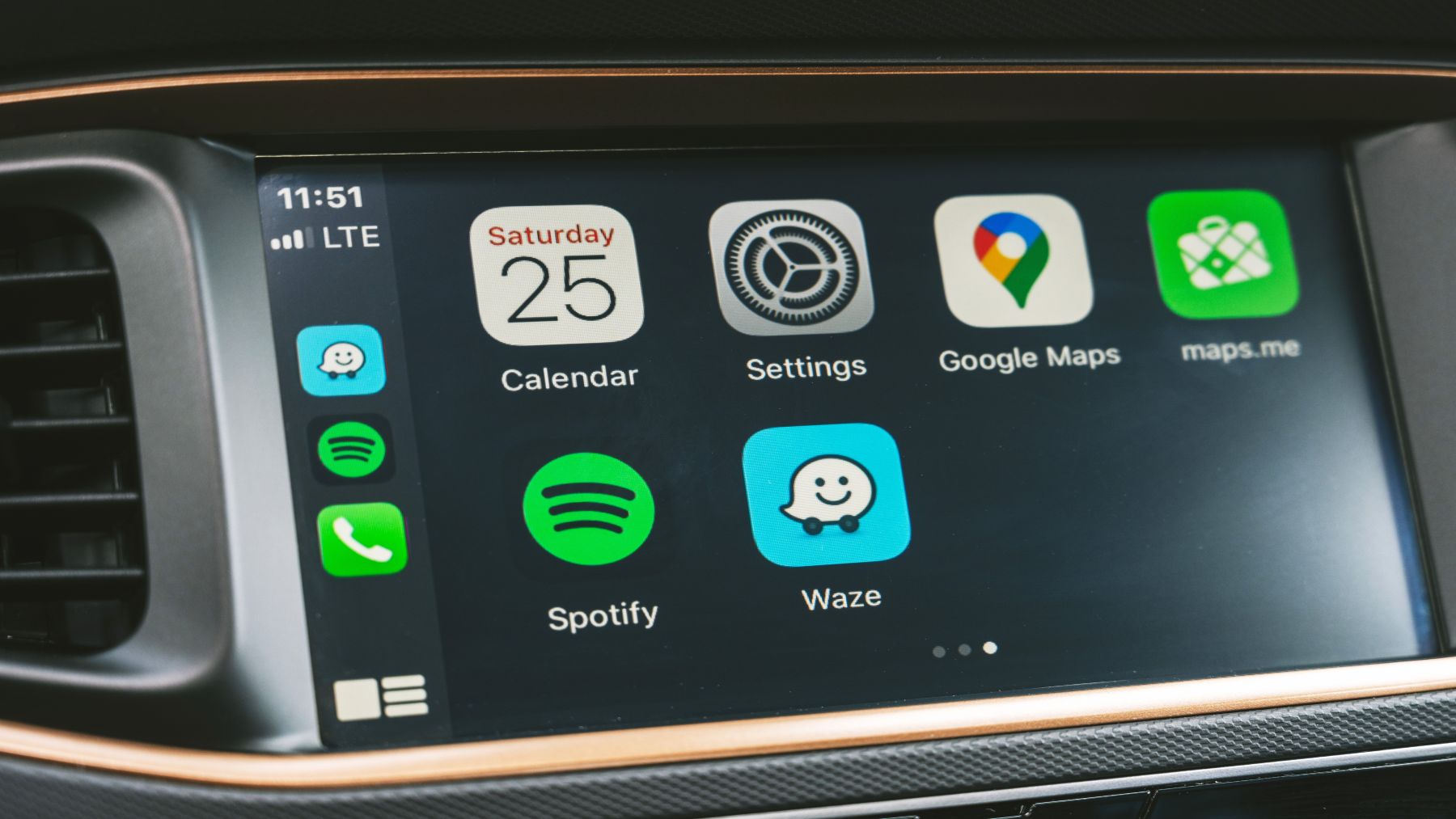
Anyone who has used it knows that Google Maps stands out for offering real-time traffic updates, alternative routes, multiple stops, and even eco-friendly routes that prioritize fuel savings. What’s more, and very importantly, the app is compatible with both Android and Apple CarPlay, making it a very versatile option for different types of users. Remember, not everyone uses Apple on their smartphones or has CarPlay in their cars. And Google Maps isn’t just a popular choice; PC Mag named it the “best navigation app” in 2024. The award went to Google for its balance of features, user trust, and ease of use.
It’s not just about living in a big city we know, but also about the constant desire to minimize problems
Times have changed, that’s a fact. But one of the moments when we are conscious of the passage of time is when, literally, most citizens are unable to get from one place to another without resorting to a smartphone. As we said before, it’s not just about living in a big city we know, but also about the constant desire to minimize problems.
By minimizing “problems,” we mean arriving late somewhere or simply wasting as little time as possible. If you live in cities like New York, Madrid, London, or Paris, citizens are accustomed to glancing at their GPS even if they know the route, simply to check traffic. The number of cars in large cities is so high that there are cities where it’s preferable to go by bike or take public transportation, just to avoid spending two hours in traffic. And this is where Google Maps or any other mobility app comes in.
Waze, the most efficient option for those who drive every day and need constant alerts about traffic conditions
In any case, although most users opt for Google Maps, many also use Waze. Even when traveling abroad or to unfamiliar cities, this app is widely used. In fact, the specialized magazine PC Mag highlighted Waze as the most efficient option for those who drive every day and need constant alerts about traffic conditions. Remember that by assigning a route to an app, it can send alerts or notifications to users to change their route in the event of an accident, a traffic jam, or any other incident that delays the trip from origin to destination.
More than 9 million users downloaded it in the United States in 2023
Waze was created in 2008 and acquired by Google in 2013, so everything stays in-house. More than 9 million users downloaded it in the United States in 2023, attracted by its ability to share real-time information about accidents, speed cameras, and detours. This app turns navigation into a collaborative experience, where drivers themselves report what’s happening on the road.
This app is user-based. Drivers can report road problems in real time. These notes, which look like footnotes in any textbook, can be instantly viewed by other users using the app and following the affected user’s route. This makes the app work collaboratively.